
English| USD
Suggested for you
More currencies
Choose a language
Sai Kung town sits at the threshold of Hong Kong's only UNESCO Global Geopark, a 150-square-kilometer expanse of hexagonal volcanic columns, sea arches and sedimentary cliffs. Most visitors arrive by scheduled ferry or kaito water taxi from Sai Kung Public Pier, though two mainland sites—High Island Reservoir East Dam and Long Ke Wan—are reachable on foot via signed trails.
Quick answer
The Hong Kong UNESCO Global Geopark is accessible from Sai Kung via kaito boats departing Sai Kung Public Pier year-round; ferries run to Sharp Island, Kau Sai Chau and the Ninepin Group daily, with morning sailings between 08:30 and 10:00 offering the shortest wait times. Two mainland geopark zones—the East Dam hexagonal columns and Long Ke Wan sedimentary coast—require no boat and are reached via the MacLehose Trail Section 1 trailhead at Pak Tam Au.
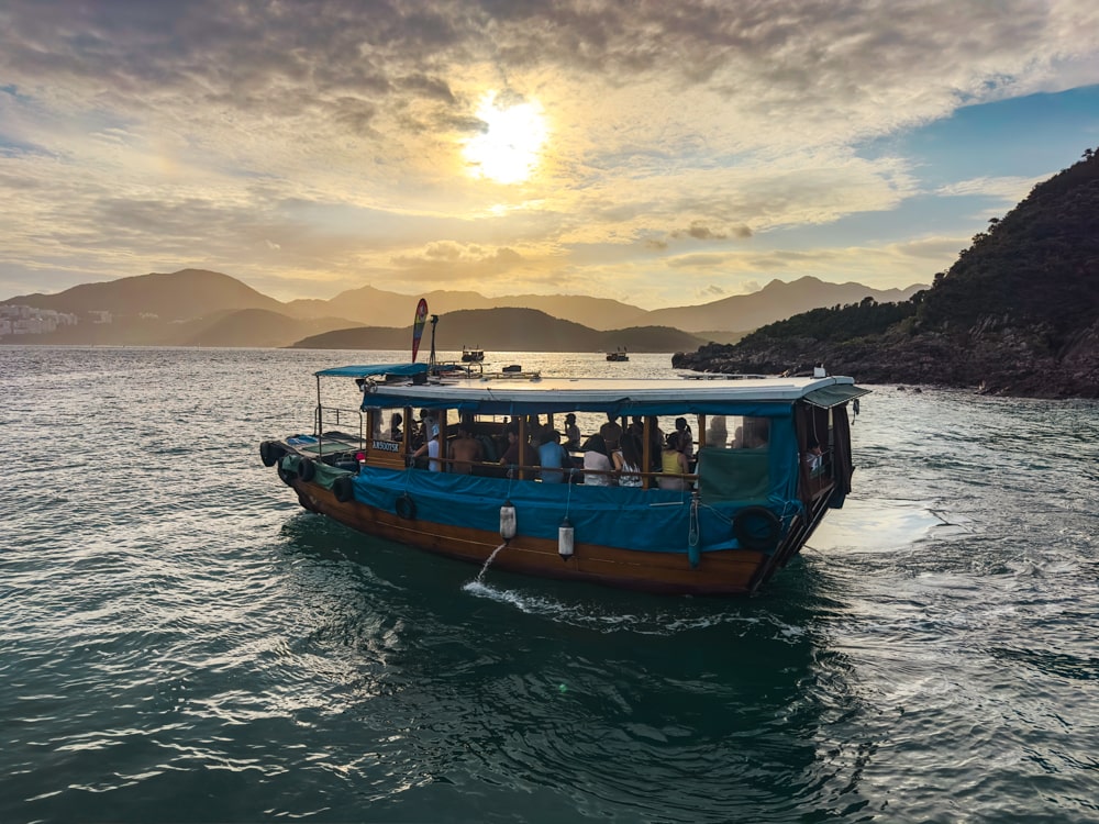
The geopark comprises four distinct regions: the Sai Kung Volcanic Rock Region, the Northeast New Territories Sedimentary Rock Region, and two smaller zones on Kat O and Lai Chi Wo. Only the Sai Kung Volcanic Rock Region—home to the park's most dramatic formations—sits within practical reach of Sai Kung town. The other three lie hours away by road and require separate planning. From Sai Kung Waterfront Park on Wai Man Road, walk 400 meters northeast along the promenade to Sai Kung Public Pier. Kaito operators cluster at the pier's eastern end, displaying laminated route cards in Cantonese and English. Boats serve Sharp Island (also called Kiu Tsui Chau), Kau Sai Chau Golf Course, and the Ninepin Group (Po Pin Chau and surrounding islets); fares range from 30 to 80 HKD depending on distance, and most captains require a minimum group of four to six passengers before departing. No advance booking exists for kaito services—arrival order determines boarding sequence. Scheduled ferries to Sharp Island and Kau Sai Chau operate on weekends and public holidays, departing at fixed intervals listed on signboards near the pier ticket kiosk. These vessels accommodate larger groups and accept payment via Octopus card. The crossing to Sharp Island takes twelve minutes; Kau Sai Chau requires eighteen. The Ninepin Group lies farther offshore—forty minutes by kaito—and sees far fewer daily sailings, making morning departure essential to secure return capacity before mid-afternoon. Two geopark highlights require no watercraft. The High Island Reservoir East Dam, crowned with hexagonal andesite columns that rival Fingal's Cave in geometric precision, sits at the terminus of MacLehose Trail Section 1. Reach the trailhead by taking green minibus 1A from Sai Kung town center to Pak Tam Au; the 5.6-kilometer trail descends through coastal scrub to the dam's western anchor. Long Ke Wan, a crescent bay flanked by tilted sedimentary strata, lies two kilometers beyond the East Dam along the same trail. Both sites remain open year-round at no charge, though the trail crosses exposed ridgelines with no shade or water sources—carry two liters per person and start before 09:00 to avoid midday heat. The geopark visitor center at Sai Kung Waterfront Park stocks bilingual trail maps and displays 3D models of the volcanic caldera that collapsed 140 million years ago, leaving the columnar joints visible today. Staff confirm current kaito schedules and weather advisories; the center opens daily and charges no admission.
“The hexagonal andesite columns at High Island Reservoir East Dam rival Fingal's Cave in geometric precision.”
The Hong Kong UNESCO Global Geopark is primarily accessible via the Sai Kung Waterfront Park. Reaching the remote geological sites requires combining public transport to Sai Kung Town with a boat connection from the local pier.
MTR Kwun Tong Line to Choi Hung Station
KMB Route 92 from Choi Hung Bus Terminus to Sai Kung Bus Terminus
Minibus 1A from Choi Hung (near MTR Exit C2) to Sai Kung
Licensed ferry service from Sai Kung Pier to Geopark sites
Plan your transit to arrive at Sai Kung Pier early to secure a seat on scheduled boat services. Most geological sites within the park are only reachable by sea, necessitating a boat transfer from the waterfront.
The best arrival window is 08:00–11:00 to avoid mid-day heat and secure space on morning boat departures from Sai Kung Pier. Planning your trip during this period ensures a more comfortable experience before temperatures peak.
—
Ideal for avoiding peak weekend congestion at the pier.
Mild and dry (20°C–26°C)
These months offer stable, comfortable weather for outdoor geological exploration.
Warm and humid (21°C–25°C)
Spring provides pleasant temperatures but visitors should monitor for occasional misty conditions.
Hot and humid (28°C–32°C)
High temperatures require frequent breaks and careful heat management during boat trips.
Verdict: The optimal time to visit is weekday mornings between 08:00 and 11:00 during the months of October or November.
Admission to the Hong Kong UNESCO Global Geopark areas is entirely free of charge. Visitors only incur costs when arranging private boat transport from Sai Kung Pier to access specific maritime geological sites.
Verdict: A typical adult pays 0 HKD for park entry, with final travel costs determined solely by the chosen boat operator.
The Hong Kong UNESCO Global Geopark is accessible daily throughout the week, including weekends and public holidays.
Prepare these essentials before heading to the geopark from Sai Kung.
Everything you need to know about hong kong unesco global geopark how to go from sai kung
To organize your visit for hong kong unesco global geopark how to go from sai kung, prioritize checking the weather and ferry schedules in advance. You can reach the area primarily by taking local ferries from the pier that transport visitors to various geological sites. Many visitors research the hong kong unesco global geopark how to go from sai kung route to ensure they secure a spot on early morning departures. Travelers often look for information on the hong kong unesco global geopark how to go from sai kung path to understand the logistics of reaching volcanic rock regions and hexagonal columns. Access is available daily throughout the week, including all weekend days. Boat services are the standard method for reaching the remote coastal features of the park, and passengers are advised to arrive at the pier early to avoid queues. Entry to the geopark areas is completely free of charge, as noted in the official guidance. The park remains open from 00:00 to 23:59 every day, allowing for flexibility in planning your exploration.